Berryman Loop
OT Courtois Section - Missouri East Loop Trails
On-line Recon Map
Loop Driving Directions and Trail Information
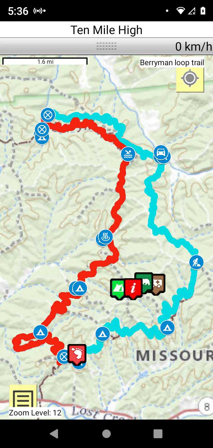
Each loop trails is shown in turquois and each shows the connection with the Secvtion Trail in red. Loop trails are typically one or two day hikes. Some loop trails are comprised of multiple intersecting trails. You pick the loop you want to hike.
Trail Map as it Appears in the App
Weather Forecast and Current Radar
MISSOURI CURRENT RADAR (INTELLICAST)
Facebook Search Links
Berryman search results in Ozark Trail Section Hikers And Backpackers FB group
Berryman search results in Missouri Hiking and Backpacking FB group
You must register with FB and join the FB groups to post!
Topographic Map Links
Do NOT hit the trail without paper maps and a compass. This ain't Disneyland!
Here is link to OT Courtois section topo.

Here is link to purchase OT Courtois Section map
Support the OT and purchase their map and booklet products.
Print the topo map and carry with you while on trail! Also carry a compass!
Beecher Spring and site of the abandoned Edward Beecher Recreation Area
Trip report: Backpacking the Berryman Trail – 2011
Brazil Creek Recreation Area water source nearby
Barryman Campground water source nearby
Harmon Springs Trail Camp does not have toilets, water source nearby.