Earthquake Ridge Loops
ONRT Ouachita Section - Arkansas Loop Trails
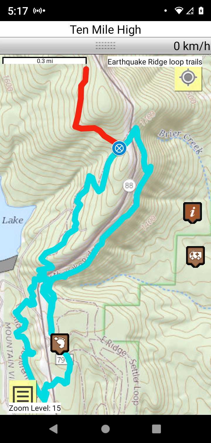
On-line Recon Map
Loop Driving Directions and Trail Information
Each loop trails is shown in turquois and each shows the connection with the Secvtion Trail in red. Loop trails are typically one or two day hikes. Some loop trails are comprised of multiple intersecting trails. You pick the loop you want to hike.
Weather Forecast and Current Radar
MISSOURI CURRENT RADAR (INTELLICAST)
Facebook Search Links
Earthquake Ridge search results in FB groups
You must register with FB and join the FB groups to post!
Topographic Map Links
Here is link toEarthquake Ridge USFS information
Here is link to Arklahoma Hiker Earthquake Ridge topo map.
Print the topo map and carry with you while on trail! Also carry a compass!