Arkansas Loop Trails
Choctaw Nation Loop - ONRT Ouachita Section
On-line Recon Map
Section Driving Directions and Trail Information
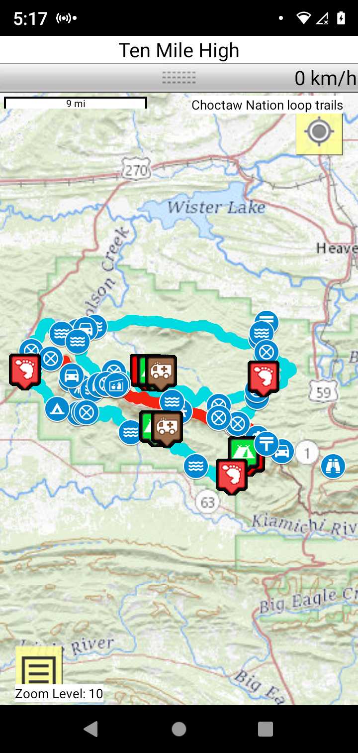
Each section trail is shown in red and each shows the connection with an adjoining loop trail in turquoise. Section trails are typically two or three day hikes but some may be 5 day hikes or more.
Trail Map as it Appears in the App
Weather Forecast and Current Radar
ARKANSAS CURRENT RADAR (INTELLICAST)
Facebook Search Links
You must register with FB and join the FB groups to post!
Topographic Map Links
Print the topo map and carry with you while on trail! Also carry a compass!
Ouachita Maps - Holson Valley to Bohannon Lake

Ouachita Maps - Boardstand-Old Military Road Loop

Ouachita Maps - Horse Thief Spring Trail

Ouachita Maps - Talimena-Bohannon Loop
