OT Marble Creek Section
Missouri East Section Trails
Section Driving Directions and Trail Information
Each section trail is shown in red and each shows the connection with an adjoining loop trail in turquoise. Section trails are typically two or three day hikes but some may be 5 day hikes or more.
NOTE:
A road walk down Hwy72/49 to Warren hill road or (and we know how hikers hate road walks) we hike a portion of the Royal Gorge trail and the Ketcherside Mtn trail These two parcels share a common boundary) and follow the Little Creek road then road walk Hwy72/49 to Warren hill road. This route crosses about 3000 feet the ERNST, JAY property.
To make the final mile to Crane Lake FS2113 has a hunters camp and that is one way to go but just to the west of FS2113 the route in red is labeled as the OT on the USGS TOPO
Weather Forecast and Current radar
MISSOURI CURRENT RADAR (INTELLICAST)
NOTE:
The Marble Creek Trail is the neglected sister-trail to the Ozark Trail. It stretches between the Taum Sauk and Wappapello sections. Currently, private land prevents the connection at the end of the trail in either direction.
Per the Forest Service, This section of the Ozark Trail which eventually will total approximately 21 miles.
According to USGS topo the route is labeled as the Ozark trail and maybe the trail referred to by the Forest Service. It is by far the best route to exit the national forest to the south. There is only about a 1000 foot section that crosses private property of SASSER, PAUL A & MELISSA J. to reach CR431. It would follow Marsh creek down to the CR431. Marsh creek is the also the property boundary with WESLING, CYNTHIA A.
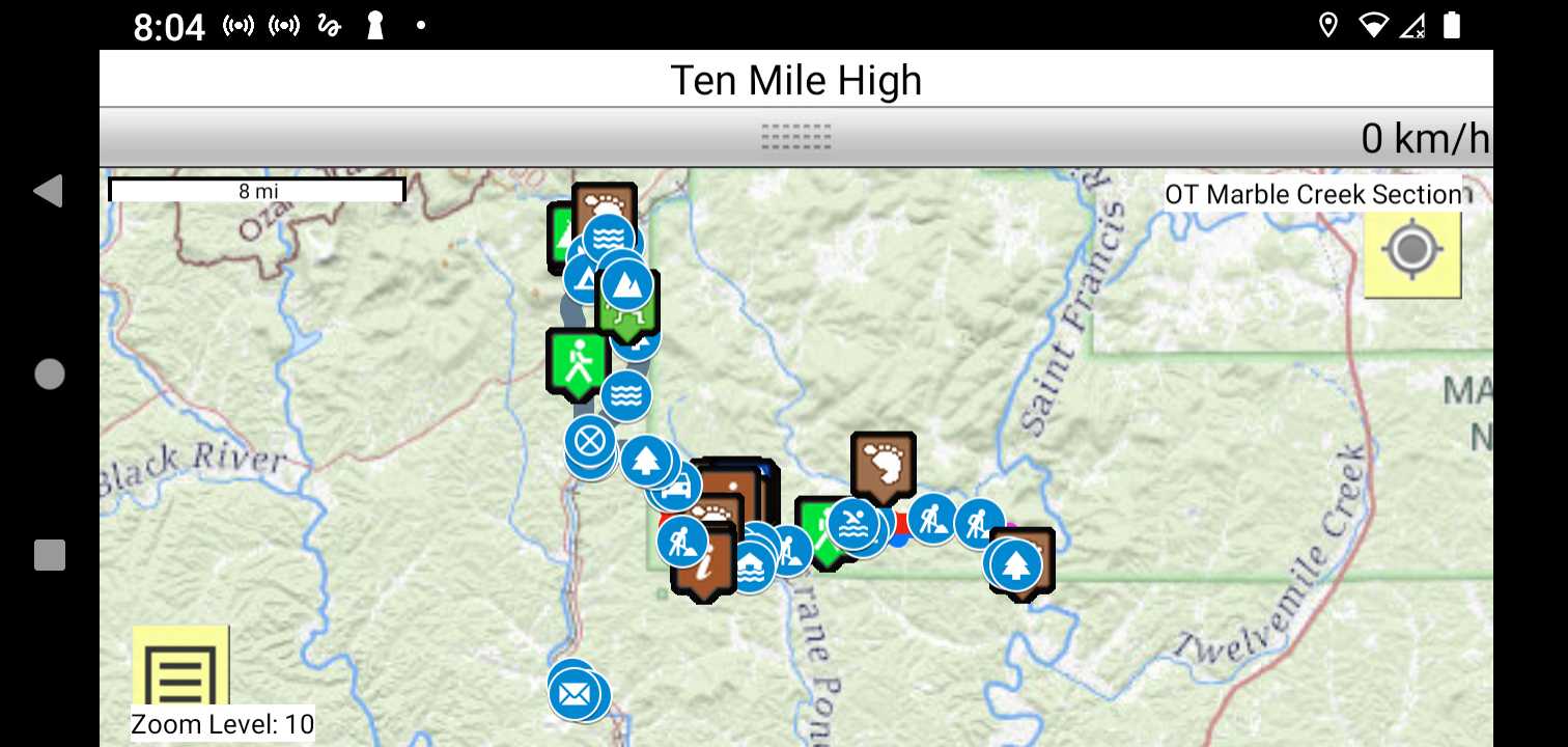
Trail Map as it Appears in the App
Facebook Search Links
Marble Creek search results in Ozark Trail Section Hikers And Backpackers FB group
You must register with FB and join the FB groups to post!
Topographic Map Links
Here is link to OT Marble Creek section topo.

Here is link to purchase OT Marble Creek Section map
Support the OT and purchase their map and booklet products.
Print the topo map and carry with you while on trail! Also carry a compass!
Handy map top have in case you need to bailout.